August 17th, 2022
Heavy showers and thunderstorms are expected to break out today leading to some flooding and disruption. Some places will miss these, but where they do occur, 30 to 50 mm of rain could fall in less than an hour and a few places may see in excess of 100 mm in a few hours where storms are slow moving. Lightning and hail will be additional hazards.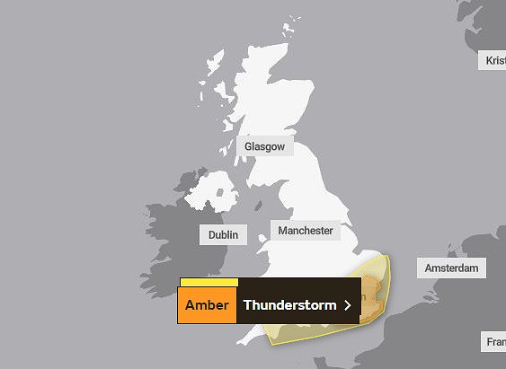
Tags: #LetsSusItOut, Environment Eco, Tarring Flood Action Group
Why not be the first to send us your thoughts

Thank you for your comments, they will appear shortly once approved.
Yellow Hazard warning today from WSCC Resilience and Emergencies Team
The Met Office has issued an Amber Warning for Thunderstorms Between 11:00 Wed 17 Aug 2022 and 22:00 Wed 17 Aug 2022Heavy showers and thunderstorms are expected to break out today leading to some flooding and disruption. Some places will miss these, but where they do occur, 30 to 50 mm of rain could fall in less than an hour and a few places may see in excess of 100 mm in a few hours where storms are slow moving. Lightning and hail will be additional hazards.
View the full warning at the Met Office Severe Weather Warning page.
What to expect
•Flooding of homes and businesses is likely and could happen quickly, with damage to some buildings from floodwater, lightning strikes, hail or strong winds
•Fast flowing or deep floodwater is likely, causing danger to life
•Where flooding or lightning strikes occur, delays and some cancellations to train and bus services are likely
•Spray and sudden flooding probably leading to difficult driving conditions and some road closures
•Some communities likely to become cut off if roads flood
•Power cuts likely to occur and other services to some homes and businesses could be lost
For more information
•WSCC Dealing with extreme weather
•WSCC Preparing for emergencies
•Follow us on Twitter for regular updates @WSCCNews and @WSCCResilience
.
Tags: #LetsSusItOut, Environment Eco, Tarring Flood Action Group
Comments (0)
No comments have been submitted yet.Why not be the first to send us your thoughts
Leave A Comment
Thank you for your comments, they will appear shortly once approved.
Topics
CrimeBroadwaterCissburyDurringtonGoringTarringWorthingWest WorthingStudent LifeCompetitionBusiness NewsLocal NewsCharity NewsEvents NewsOpinion
Recent Posts
 Worthing community groups invited to express an interest in development fundingApril 9th, 2024
 Local Estate Agent gives property advice and opinion with Phil SpencerMarch 29th, 2024Community to help design Adur and Worthing’s services for the futureMarch 22nd, 2024
Have You Seen...
 Brightening up Montague PlaceApril 26th, 2022
 ANGER AT MONSTROSITY OF 5G POLE PROPOSAL AT BROADWATER SHOPSMarch 25th, 2021